Data Basin
powered by

Yale Framework

Integrating Climate Adaptation and Landscape Conservation Planning

Get Started

    Before You Start
  • Framework
    Recommendations
  • Coping with Uncertainty
  • Take a Data Basin Tour
    Using the Framework
  • The Framework Matrix
  • Choosing adaptation objectives
  • Choosing ecological analysis levels
    About the Framework
  • About Data Basin
  • Supporting Documents
  • Framework FAQ
  • ?Help
  •  Glossary

Explore

    Pilot Projects
  • Overview
  • Conservation Biology Institute
  • EcoAdapt
  • Florida Natural Areas Inventory
  • Geos Institute
  • NatureServe
  • University of Washington
    Adaptation Objectives
  1. Protect current patterns of biodiversity
  2. Protect large, intact, natural landscapes and ecological processes
  3. Protect the geophysical setting
  4. Identify and manage areas that will provide future climate space
  5. Identify and protect climate refugia
  6. Maintain and restore ecological connectivity
    Approaches & Tools
  • Conducting Assessments of Species Distributions
  • Conducting Assessments of Species Landscape Movement
    Data
     …by topic
  • Abiotic Data
  • Biological Data
  • Cultural Data
  •  …by type
  • Galleries
  • Maps
  • Datasets

Create

  • Create a Map
  • Import a Dataset
  • Create a Group
  • Create a Gallery

Community

  • Framework Groups
  • Data Basin Members
  • The Science Panel
  • The Data Basin Team

Workspace

Your workspace is your dashboard for accessing and managing your content, bookmarks, and groups, as well as viewing messages and seeing your recently viewed content.

You need to be signed in to access your workspace.

Sign In    or    Sign Up
  • Yale Framework |
  • Galleries |
  • MC1 Simulation Results for the Sierras (CA) - multiscale (Yale)

MC1 Simulation Results for the Sierras (CA) - multiscale (Yale)

Jun 5, 2012 (Last modified Jun 6, 2012)
Created by Dominique Bachelet
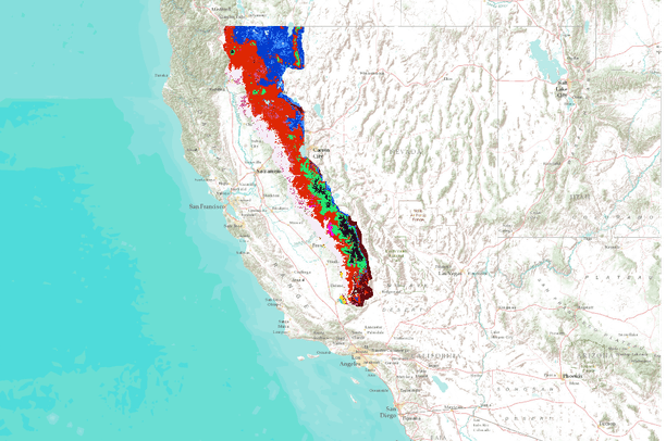
MC1 Simulation Results for the Sierras (CA) - multiscale (Yale)

About

The goal of the Yale framework project is to add robust, downscaled, climate-change effects assessments to what is already a comprehensive, science-based, and collaborative conservation planning effort in the Sierra Nevada ecoregion, and to compare alternative analytical approaches and resolutions for assessing climate impacts on vegetation and on two carnivore species of conservation concern: fisher (Martes pennanti) and marten (M. americana [caurina]).

This gallery includes only climate and vegetation spatial datasets that were generated using simulation models.
Tags
climate change, usa, dynamic vegetation model, sierra nevada, mc1, california, simulation

This gallery is visible to everyone

Gallery contains
22 Folders
110 Datasets
Usage
Bookmarked by 3 Members
Conservation Biology Institute

About the Gallery Author

Dominique Bachelet
climate change scientist with Oregon State University

Dominique received her Master’s degree in 1978 in Lille (France) and her Ph.D. in 1983 from Colorado State University with a thesis focused on biogeochemical cycles in the shortgrass prairie. In 1984 she went to U.C. Riverside as a postdoc simulating nitrogen fixing shrubs in the Sonoran desert then...

  • ABOUT DATA BASIN
  • TERMS OF USE
  • SUPPORT SERVICES
  • CONTACT US
© 2025 Conservation Biology Institute